
© La Plagne
Maps of La Plagne
Download the essential La Plagne maps & plans
Updated
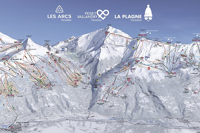
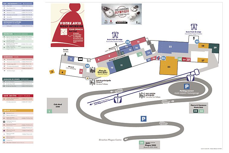
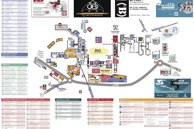
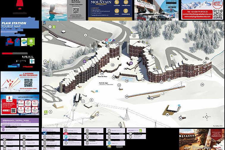
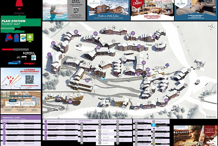
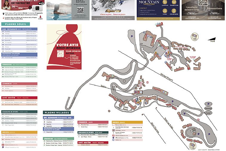
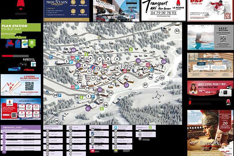
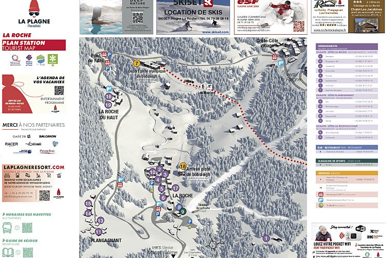
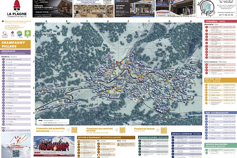
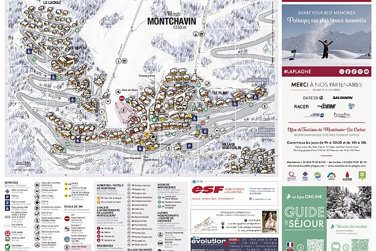
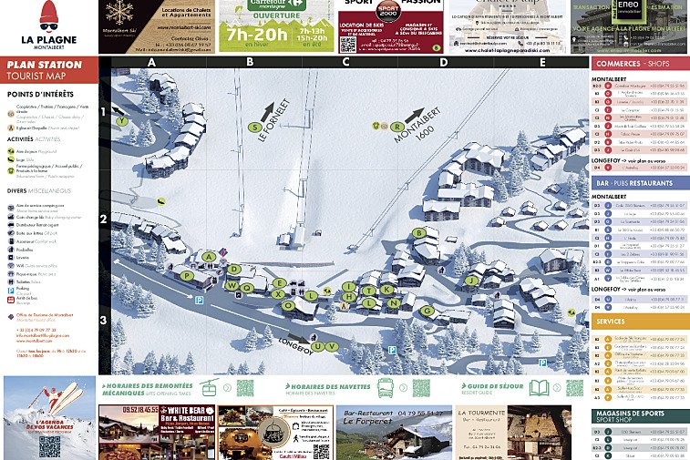
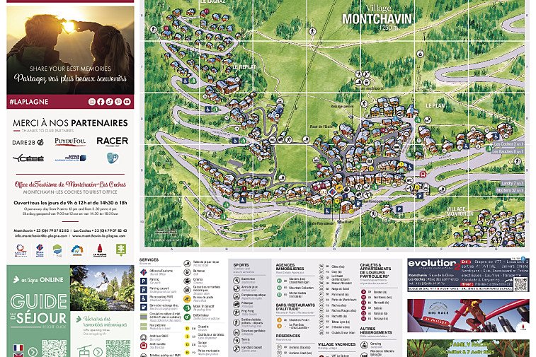
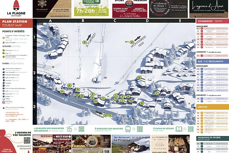
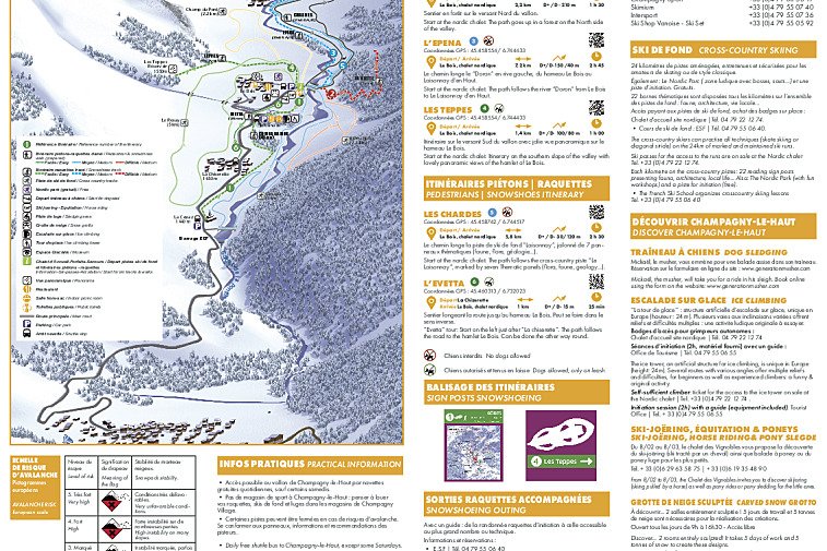
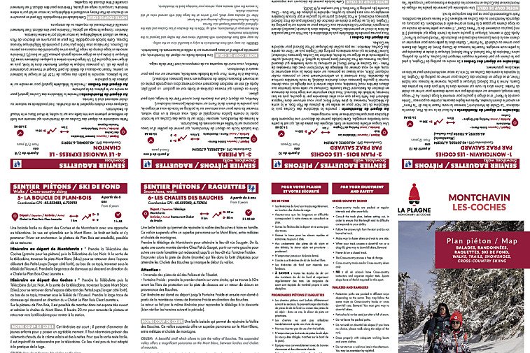
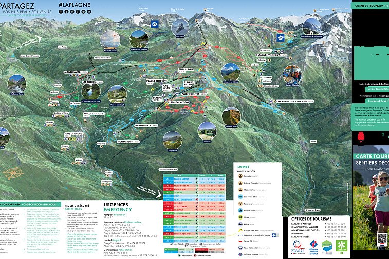
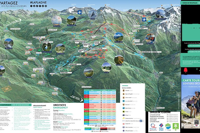
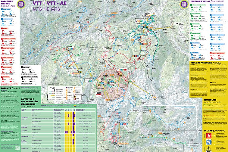
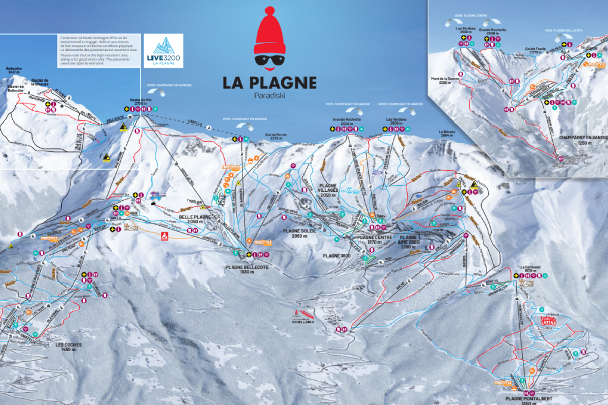
We hope this selection of piste and lift maps, street maps, and activity area maps for La Plagne will help you find your way around so you can make the most of this great part of the world.
La Plagne is made up of six high altitude resorts, and all linked by a free public transport system.
Piste maps
La Plagne Piste Maps |
---|
La Plagne piste map |
Les Arcs piste map |
Lifts marked on the piste map using straight black lines are of four types: button tow/drag lift, chairlift, télécabine and télephérique. They have the corresponding abbreviations:
- TK - téléski (drag lift)
- TS - télésiege (chairlift)
- TC - télécabine (gondola)
- TPH - téléphérique (cable car)
Anything prefixed/suffixed with “Express” means a six-person, fast chairlift.
Town maps
Snowshoeing, winter walking & ski touring maps
La Plagne Snowshoeing, Winter Walking & Ski Touring Maps |
---|
La Plagne winter walking map |
Montchavin - Les Coches snowshoe trail map |
Plagne Montalbert snowshoe trail map |
Champagny snowshoe trail map |
Champagny-le-Haut snowshoe trails map |
La Plagne ski touring routes map |
Cross-country skiing maps
La Plagne Cross-Country Skiing Maps |
---|
La Plagne cross-country skiing map |
Montchavin - Les Coches cross-country skiing map |
Montalbert cross-country skiing map |
Champagny cross-country skiing map |
Hiking & walking maps
La Plagne Hiking Maps |
---|
6D Trek Hiking Map |
Ô Tour de la Vallaisonnay Hiking Map |
Mountain bike trail maps
La Plagne Mountain Biking Maps |
---|
La Plagne region mountain bike trail map |
La Plagne bike park map |